Avalon Park Daytona Beach January 2024 Updates
As Avalon Park moves closer to starting its 30-year project, Avalon Park Daytona, it is pleased to put forth a traffic plan providing a comprehensive road network that will serve the needs of Northeast Volusia for generations to come. The plan provides for Avalon Park building the roads needed for each phase in conjunction with it. The cost of the roads is more than double what Avalon Park would otherwise pay in transportation impact fees, making this a positive outcome for everyone.
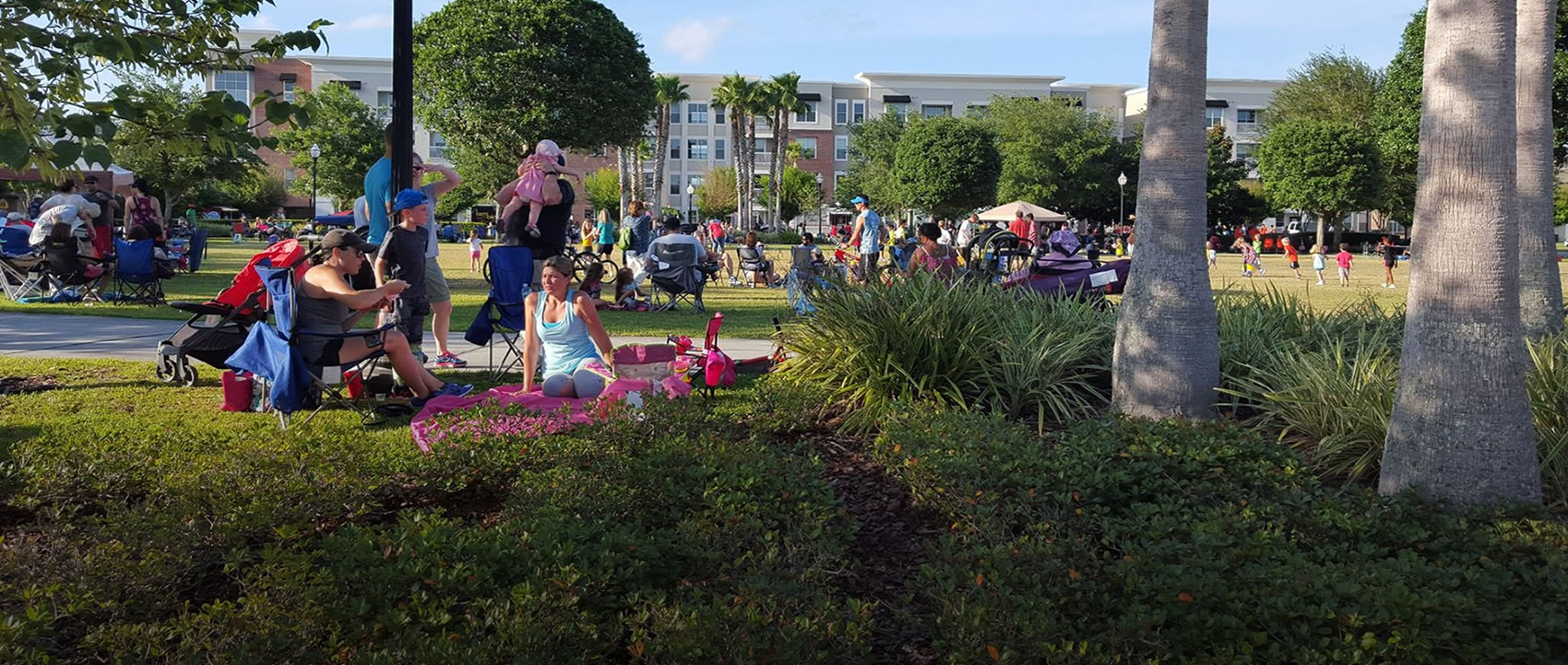
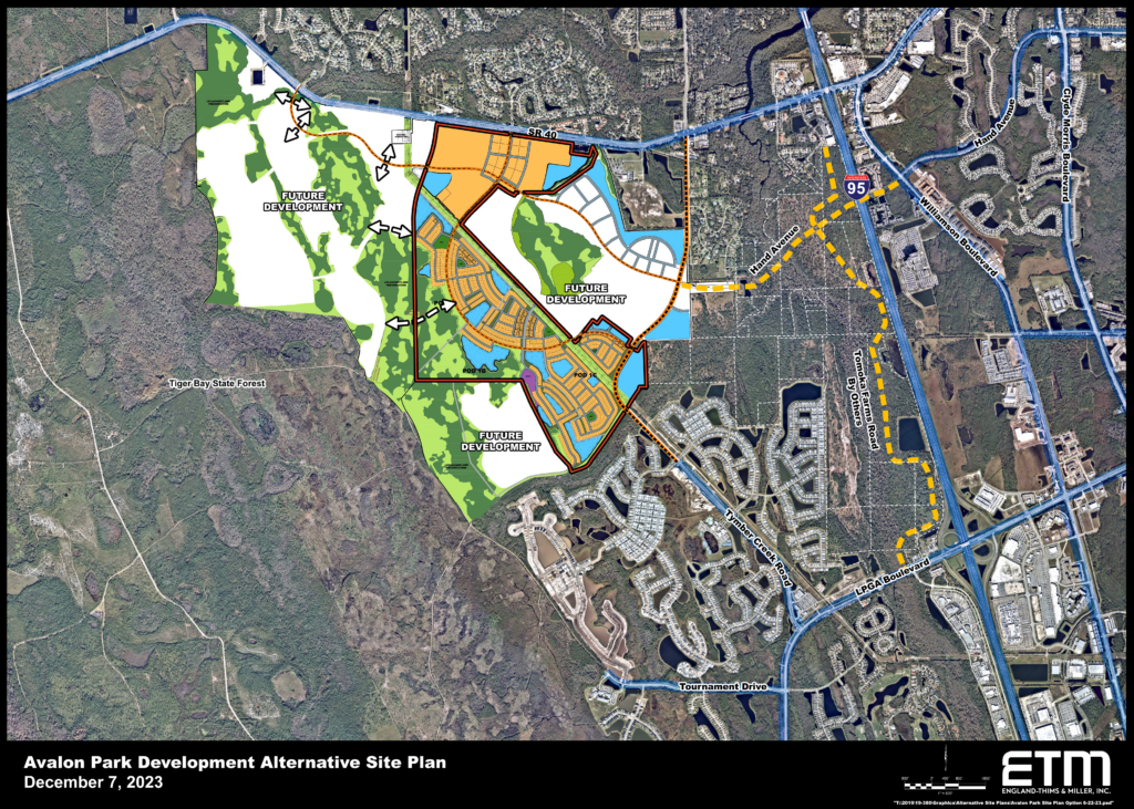
Once completed, Avalon Park Daytona will be a walkable community containing around seven thousand eight hundred residential units and one million square feet of non-residential space, creating a town center and other amenities. The Plan provides a mixture of housing types including single family, townhome and multi-family products. Approximately forty percent of the homes will be multi-family units clustered in the town center, providing homes for an economically diverse community and freeing a substantial portion of the property for conservation and recreation along the Tiger Bay Forest border. The town center will allow residents to satisfy their daily needs without leaving the community.
Avalon Park is creating the community without increasing the number of units or density west of I-95 beyond what has been planned and approved for many years. The proposed one million square feet of non-residential is significantly less than the three and a half million square feet allowed in the area. The residential units consist primarily of homes already permitted on the property, with some added by converting the excess non-residential to residential and some by transferring development rights to the community from land Avalon Park owns just to the east and adjacent to the Tomoka River. In effect, Avalon Park is concentrating the housing that could be built into one location, creating a walkable small town with its own business center.
The roads channel traffic parallel to State Road 40 and then south down Avalon Park Blvd, Tournament Drive extension and Tymber Creek Road to LPGA Boulevard and US 92. The much-anticipated LPGA and I-95 road and bridge improvements should be available by then. Ultimately, traffic will also flow east on Hand Avenue over the river and interstate to the east side of I-95. If the county or others extend Tomoka Farms Road north from LPGA Boulevard to State Road 40, Hand Avenue would intersect it, providing additional traffic alternatives.
Avalon Park plans to use much of its Tomoka River property to extend Hand Avenue toward I-95 and for a conservation easement along the Tomoka River. The Tomoka Farms Road extension will also cross the Tomoka River property, should the county or others build it. The bridge over the Tomoka River designed by Avalon Park will be over one thousand feet long, spanning the river, the wetlands, and the required buffer area. With so much of the property taken up with roads and the environmental easement, Avalon Park is transferring most of the Tomoka River property’s development rights to Avalon Park Daytona and will record a covenant preventing Avalon Park or any subsequent owner from reacquiring those rights.
Avalon Park proposes to build the community in successive phases which include specific roadway improvements to support that phase. Once the City of Daytona Beach approves the plan for a phase, Avalon Park will build the roads required by that phase, thereby ensuring that road construction both in and around the community keeps pace with the new residential and nonresidential build-out of Avalon Park Daytona.
Graphic Display
Maps below show the roads to be constructed. The various roadway sections are color-coded to show distinct phases of construction. The roadways depicted will be constructed as the development entitlements they support become available. Each color-coded roadway has a specific set of entitlements and additional traffic which it supports.
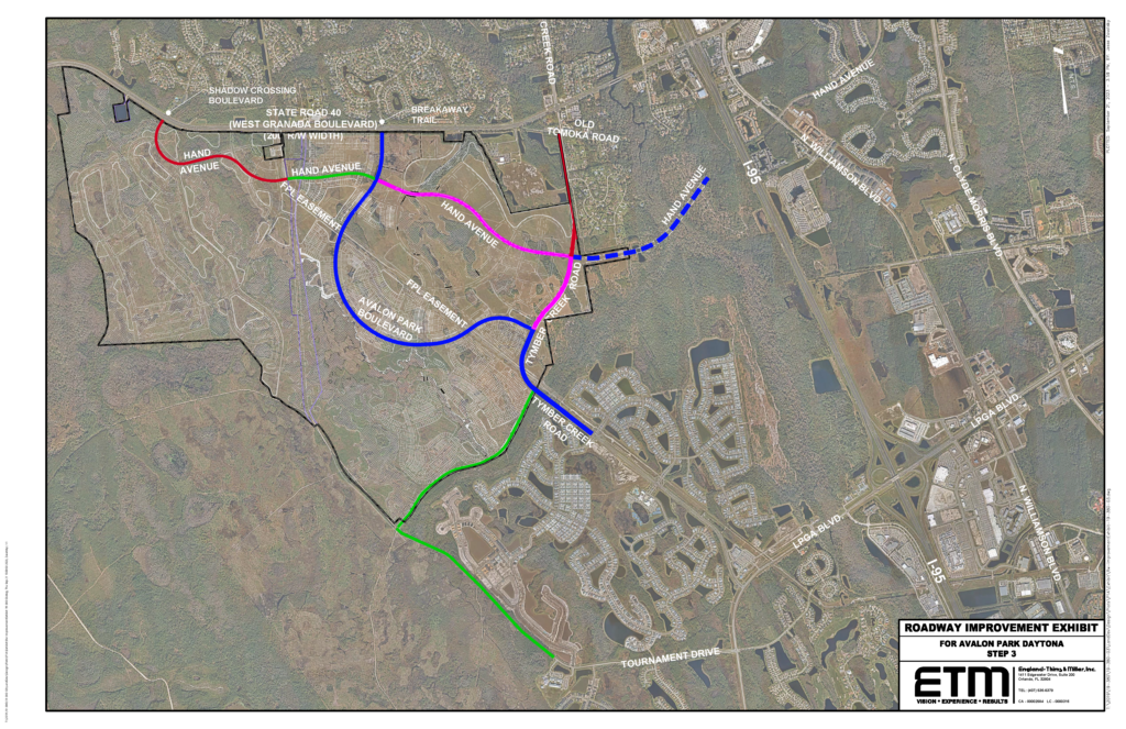
*Graphics are subject to change at anytime without notice.